Select Page
Patrick L. Friend, Ph.D., P.G., C.C.P.
Global Strategic Advisor

Patrick L. Friend, Ph.D., P.G., C.C.P.

Global Strategic Advisor

Dr. Patrick Friend is an international coastal and marine scientist, geologist, and business strategist with more than 20 years of experience in project delivery and management for both the governmental and private sectors. His primary areas of scientific expertise include bio-sedimentology, sediment transport, and coastal geomorphology. Dr. Friend’s expertise as an economic geologist encompasses opportunity screening, strategic planning, probabilistic risk assessment, asset evaluations and acquisitions, quality assurance, and due diligence.

Dr. Friend has consulted extensively for port and harbor authorities, and coastal stakeholders. He spent 8 years as a research fellow at the...

Dr. Patrick Friend is an international coastal and marine scientist, geologist, and business strategist with more than 20 years of experience in project delivery and management for both the governmental and private sectors. His primary areas of scientific expertise include bio-sedimentology, sediment transport, and coastal geomorphology. Dr. Friend’s expertise as an economic geologist encompasses opportunity screening, strategic planning, probabilistic risk assessment, asset evaluations and acquisitions, quality assurance, and due diligence.

Dr. Friend has consulted extensively for port and harbor authorities, and coastal stakeholders. He spent 8 years as a research fellow at the University of Southampton’s world-renowned National Oceanography Centre, where he was scientific lead on three large, multidisciplinary European Union projects. He spent 10 years in the global offshore energy industry, working in multiple countries as a senior geologist and senior basin analyst. He returned to coastal and marine science in 2016 and is presently managing and developing projects in the Gulf of Mexico, Latin America, and West Africa.

Dr. Friend is a writer, reviewer, and editor for international scientific journals and has published on topics ranging from sediment transport pathways in dredged estuaries to bio-sediment interaction in the coastal zone, and shallow gas accumulation in modern deltaic systems. His present research focuses on nearshore sediment transport in the Gulf of Mexico and the physical behavior of nannofossil ooze.

Read More    Read Less   

Contaminated Sediments

Demonstration of a New Tool for the Rapid, In Situ Mapping of Contaminated Sediments, Washington, DC Developed, implemented, and now project manager for a major U.S. Department of Defense Environmental Security Technology Certification Program (ESTCP) project that demonstrates the use of an aquatic gamma spectrometer for the in situ mapping of contaminated sediments in riverine, lacustrine, and estuarine environments. In situ gamma spectroscopy has been successfully used in Europe for the rapid mapping of sediments contaminated with PCBs, PAHs, and heavy metals, but has not yet been demonstrated in the U.S. The technology takes advantage of the adsorption properties of clay minerals and the naturally occurring presence of radionuclides in the clay minerals. The method is particularly useful during the screening phase to identify hotspots for further investigation. The results will be disseminated through presentations at ESTCP symposia, reports, and publication in international journals.

Coastal Resilience

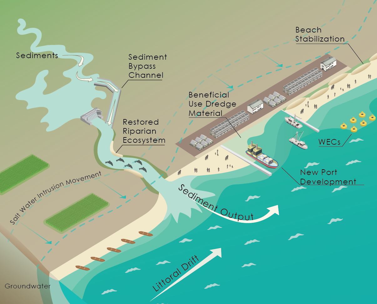
Beneficial Use Dredge Material (BUDM) for Nearshore Berm Construction, Gulf of Mexico, Texas Managed project that employed tracers to examine the effectiveness of using a nearshore berm constructed from dredge material deposited in a licensed placement area to supply sand to the adjacent beach. Presented the results at the American Shore and Beach Preservation Association’s national annual meeting in 2019. This was a multi-partner project comprising government agencies, a local university, and a city stakeholder. The project consisted of placing a dual signature (fluorescent and magnetic) tracer on the newly constructed berm half a mile offshore, just outside closure depth. Sixty offshore and 50 onshore (beach) sediment samples were collected at fixed locations and at varying time intervals up to 15 months after tracer deployment. In total, more than 900 sediment samples were collected and analyzed for the presence of tracer. An upward looking acoustic Doppler current profiler (ADCP) was deployed continuously for 1 year near the berm, and regular bathymetric surveys of the berm were conducted. From the sample analyses, it was possible to calculate longshore and cross-shore sediment transport rates, directions, and fluxes. The results of this project will be used to calibrate the U.S. Army Corps of Engineers sediment transport model for the area and will be published in due course.

Coastal Geomorphology

Trend Vector Modeling of Sediment Transport Pathways Offshore of a Gulf Coast Barrier Island, Texas Developed and implemented a trend vector modeling project for an island city stakeholder interested in understanding large-scale sediment transport processes. Leveraged an archived data set of surface sediment grab samples collected by the Texas Bureau of Economic Geology in the late 1970s to produce a trend vector analysis of sediment transport pathways for a 50-mile section of the Gulf of Mexico coastline to a distance of 10 miles offshore. The project is unique in that it uses a geostatistical (semi-variogram) method to define the spatial scale at which trend vectors are calculated. The resultant model defines a unique snapshot of sediment transport on the inner continental shelf immediately prior to the grab sample survey. It is not understood whether the same general transport pathways exist today; however, it is particularly interesting to note that modern pathways identified during the BUDM project (see above) are similar. Furthermore, the model clearly identifies an area of divergence where a hinge point exists today. The results were presented as a poster at an American Shore and Beach Preservation Association meeting.
Transport Pathways of Sediment in a Dredged Estuarine System, Southwest England Designed and led a ground-breaking project for a local port authority into the sediment transport pathways and fate of dredged material placed in a disposal area outside the harbor entrance. Used an integrated approach comprising new data collection (offshore and riverine grab samples) combined with archived data to describe long-term (100-year) morphological and bathymetric changes to the inner continental shelf and deep water harbor, the latter dredged for more than 120 years. Described sediment dispersal patterns from the dredge spoil placement area using grain size trend analysis, the first time this approach had been used. The project concluded that the dredging of the estuary had altered its morphology in such a way that it acted as a highly effective trap for riverine sediment eroded from its upper reaches and for sediment, including previously dredged sediment, entering from offshore. Results are published in the journal Estuarine, Coastal and Shelf Science.

Coastal Science

Bio-dependent Bed Parameters as a Proxy for Saltmarsh Sediment Stability, Ria Formosa, Portugal Planned and executed a project that examined the stability of saltmarsh sediments affected by sea level rise and habitat loss due to propeller wash as part of the EU’s Feedback of Estuarine Circulation and Transport of Sediments on phytobenthos (FECTS) program. Measured erosional shear stress using a CSM Mk III. Other parameters measured were chlorophyll‑a, colloidal carbohydrate, sediment water and organic contents, and bed elevation. Examined interdependent relationships using multiple regression and principal components analysis. Collaborated closely with scientists from the University of Ferrara, Italy, communicating results through international conference presentations and journal publication. The results of this project are being used today by coastal engineers and scientists working with nature to construct artificial saltmarshes, and in thin layer placement applications using dredged sediments. The results of this project were reported in a publication that won the most cited paper award 2003–2007 for the international journal Continental Shelf Research (Elsevier).

Hydrodynamics

Hydrodynamic Model Calibration for MOSE Flood Protection Project, Venice, Italy Managed the collection of current velocity and bottom shear stress data to calibrate the hydrodynamic model for Venice Lagoon as part of the high profile MOSE flood barrier scheme designed to protect Venice from high water events due to a combination of natural and anthropogenic causes. Worked closely with modelers from Italy’s Institute of Marine Science (ISMAR) during the model construction and testing phases to ensure correct application of the data. The model enabled examination of the effects on circulation and flushing times within the lagoon of opening and closing the proposed MOSE flood barrier. The project was funded by a consortium of public and private companies responsible for the construction and implementation of the MOSE flood barrier. The results were published in the book Scientific Research and Safeguarding of Venice (P. Campostrini, ed., CORILA, pub.).
Erosion Rates, Erosion Thresholds, and Settling Velocities of Cohesive Sediments in the Humber Estuary, England Led the in situ measurement of erosional and depositional parameters used for calibrating a hydrodynamic model of the Humber Estuary for a large UK port authority. Rapid and safe data collection using in situ instrumentation was possible by use of a hovercraft to traverse dangerous intertidal muds and sands safely, and to cover large distances quickly in this highly dynamic estuary. The data were collected as part of a managed retreat project designed to examine the effects on estuarine circulation of allowing the sea to flood farmland adjacent to the estuary during exceptional high tides. Managed retreat is often the most cost effective option in the United Kingdom to adapt to the effects of sea level rise and climate change, and is especially useful in non-residential, low-grade farmland areas. The results of this project are published in a National Oceanography Centre Southampton Research and Consultancy Report.

Marine Science

Sediment Dispersal from a Small Mountainous River during Flash Flood Conditions, Têt River, France Led the collection and analysis of riverine total suspended solids data, nearshore sediment sampling, bathymetry, and ADCP surveys for a multidisciplinary project designed to investigate a mountainous river undergoing a flash flood event. Modeled the nearshore transport of sediment using a grain size trend vector approach. The project was funded by the EU’s European Margin Strata Formation (Eurostrataform) program; participated as scientific lead for the University of Southampton’s School of Ocean and Earth Science. Small mountainous rivers are estimated to account for approximately half the annual suspended sediment load introduced to the oceans; however; they are often difficult to sample and model due to the unpredictable nature of flash flood events. By sampling during and immediately after a flood event, it was possible to follow in quasi-real time the transport of the suspended sediment and bedload from the riverine system to the coastal deltaic system and beyond. Presented the results at an international conference in Venice, and published in the journal Continental Shelf Research.
Shallow Gas Off the Rhône Prodelta, Gulf of Lions, France Led an ADCP survey of the Rhône prodelta in the Gulf of Lions, France, as part of an integrated project to examine methanogenesis in modern deltas funded by the EU’s Eurostrataform program. Published the results as a contributing author on a paper that hypothesized that sufficient organic material was delivered to the Rhône prodelta during flood events, and buried rapidly enough by terrigenous deposits, to prevent aerobic oxidation, thereby allowing methanogenesis with burial to occur. There is a continuing research interest in shallow gas formation in deltas and prodeltas, from both economic and safety (slope stability) viewpoints. The results of this project were published in the journal Marine Geology.
Morphological Changes Induced by the Rhône Flood of 2003, Gulf of Lions, France Lead scientist on this project, which was part of the EU’s Eurostrataform program. Collected shallow water bathymetry and ADCP data as part of a pre-and post-flood monitoring program not only to examine morphological changes induced by the extreme flood event in 2003, but, importantly, also to provide an analysis of the solid load transfer process towards the prodelta. Crucially, it was found that the delta acts as a temporary sink, and that material is transferred to the prodelta and onwards to the shelf-slope system by mass movements of material deposited beforehand, and not via a steady supply mechanism as previously thought. The results were published in the journal Marine Geology.
Carbonate Mud Mound Stability, Porcupine Seabight, Atlantic Ocean (Irish Territorial Waters) Led a project designed to measure the erodibility of carbonate mud mound sediments collected at ~600 m water depth from a cold water coral (Lophelia pertusa) carbonate mud mound in the Porcupine Seabight. The project involved box-coring, then running a series of erosional jet tests on the sediment surface to measure erosional shear stress. The project, partially funded by an international exploration and production company, formed part of a UNESCO scientific expedition to examine geological processes on the northeast Atlantic margin and was one of the first to describe a carbonate mud mound in the Porcupine Seabight. The results were presented at North-East Atlantic Slope Processes conference, National Oceanography Centre, Southampton, UK.
Effect of Oceanographic, Riverine, and Atmospheric Forcing Factors on River Plume (Jet) Characteristics, Various European Rivers Lead scientist on this project, which was funded by the EU’s Eurodelta (European coordination on Mediterranean and Black Sea Pro-deltas) initiative. Collected multiple data sets from European governmental and academic institutions and combined with satellite data to produce for the first time an analysis of jet characteristics in relation to three co-varying forcing factors: oceanographic, riverine, and atmospheric. The results showed the strong influence of dams on the sediment supply to the northwest Mediterranean shelf, as well as the relatively large effect of smaller catchments, confirming Milliman and Syvitski’s earlier work (1992) on the importance of small mountainous rivers. The results are reported in a National Oceanography Centre, Southampton, Research and Consultancy Report.

Environmental Impact Assessment

Economic and Environmental Impact Assessment of a High Potential Ocean Thermal Energy Conversion (OTEC) Site, Puerto Rico Led evaluation project that examined suitable locations for the siting of an OTEC plant in Puerto Rico. Identified the criteria necessary to minimize the effects of OTEC on the environment, and included a cost-benefit analysis of using deep ocean water applications such as air conditioning and aquaculture to offset the increased cost of electricity generation from OTEC compared to fossil fuel generation. The project concluded that a closed cycle, land-based plant with a generating capacity up to 10 MW—enough for about 12,000 homes—would have a negligible physical impact with a small, localized biological impact. OTEC is presently enjoying a resurgence in popularity as a clean energy source, and is seen as beneficial for island communities with access to a deep, cold water source. The results of this project are published in the International OTEC Association Newsletter.

Environmental Economics

Risk Evaluation, Strategic Planning and Business Development of Geological Assets, Santos Basin, Brazil (2013–2016) As a Senior Basin Analyst for an international exploration and production energy company headquartered in Bogota, Colombia, managed five oil and gas license areas in the Santos Basin, Brazil. Designed, planned, and implemented geological and geophysical projects to evaluate subsurface hazards and value potential, undertook probabilistic risk assessments for new projects, and developed new business proposals for Brazil and West Africa. Made recommendations to senior management concerning strategic planning and concept generation, managed the asset portfolio, and reported to external auditors. Participated in company-wide reviews and contracted external specialists as required.
Risk Evaluation, Quality Assurance, and Subsurface Investigations for Licenses and Major Asset Acquisitions in Denmark, Norway, Greenland, Gulf of Mexico (U.S. and Mexico), Guyana, and Brazil (2007–2013) As Senior New Business and Exploration Geologist for a major European exploration and production energy company, undertook probabilistic risk assessment and quality assurance for large (up to $2.4 billion) asset acquisitions in Brazil. Advised on strategy and business development, and planned and implemented geophysical and geological investigations, shallow hazards and risk assessment in Brazil, Gulf of Mexico, Denmark, Norway, and Greenland. Developed geological models, notably for the Middle Jurassic riverine system in the southern North Sea, and the emergent offshore west Greenland play, where a large grab sampling survey was designed and implemented.
RETURN TO OUR TEAM PAGE