Select Page
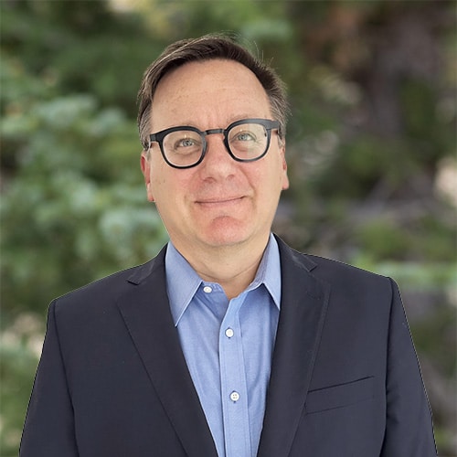
Daniel Doolittle
Principal, Offshore Wind

Daniel Doolittle

Principal, Offshore Wind

Mr. Daniel Doolittle is a broadly trained marine scientist and senior program manager with more than 25 years of industry, government, academic research, and consulting experience. He specializes in the marine geological, geochemical, and environmental fields and has specific core competencies in the following areas:

  • Environmental and exploration consultancy services to the offshore wind, oil and gas, and renewable energy industries
  • Expertise in carbonate sedimentology, hydrocarbon seeps exploration, environmental baseline studies, seafloor habitat mapping, and technology development for seafloor remote sensing sensors and systems
  • Strategic market and busine...

Mr. Daniel Doolittle is a broadly trained marine scientist and senior program manager with more than 25 years of industry, government, academic research, and consulting experience. He specializes in the marine geological, geochemical, and environmental fields and has specific core competencies in the following areas:

  • Environmental and exploration consultancy services to the offshore wind, oil and gas, and renewable energy industries
  • Expertise in carbonate sedimentology, hydrocarbon seeps exploration, environmental baseline studies, seafloor habitat mapping, and technology development for seafloor remote sensing sensors and systems
  • Strategic market and business development, program management, and all phases of project delivery.

Mr. Doolittle’s extensive field experience includes projects in multiple frontier offshore basins, remote regions, and most global oceans, including high latitude waters from Antarctica to the Arctic.
Read More    Read Less   

Offshore Wind

Benthic Habitat and Essential Fish Habitat Survey, New York Bight Responsible for the design and delivery of four seasonal surveys to map the benthic communities and essential fish habitats within the lease area and along multiple export cable corridor options. Surveys were conducted using a mix of sampling equipment, including real-time video equipped grab samplers, sediment profile imaging (SPI) cameras, and towed video systems. Supported client with contracting, survey design, technical consultations on benthic survey plan creation, presentation, and submission to federal and state regulators and agency stakeholders.
Benthic Habitat and Essential Fish Habitat Survey, Offshore New Jersey Responsible for the design and delivery of two seasonal surveys to map the benthic communities and essential fish habitats within the client’s lease area and along multiple export cable corridor options. Developed Coastal and Marine Ecological Classification Standard (CMECS)-compliant benthic community and essential fish habitat maps, charts, and visualization materials. Supported client with technical consultations on benthic survey plan creation, including station placement, and supported client during meetings and presentations to federal regulators.
Benthic Habitat and Essential Fish Habitat Survey, Offshore Massachusetts Responsible for the design and delivery of six seasonal surveys to map the benthic communities and essential fish habitats within the client’s lease area and along two export cable corridor options. Developed CMECS-compliant benthic community and essential fish habitat maps, charts, and visualization materials.
Benthic Habitat and Essential Fish Habitat Survey, Offshore Massachusetts Responsible for the delivery of a benthic habitat survey along the federal waters portion of the development’s preferred export cable route. Data were collected from real-time video-equipped sediment grabs and towed video. Developed CMECS-compliant benthic community and essential fish habitat maps, charts, and factual reports.
Benthic Habitat and Essential Fish Habitat Survey, Gulf of Maine Responsible for the design and delivery of a geophysical, grab, video, and SPI–plan view (PV) survey tasked with mapping the benthic communities and essential fish habitats along a floating wind export cable corridor to support future renewable energy development in Maine state waters. Supervised the creation of charts and visualizations and reports to support the development of state permitting requirements for the nation’s first floating wind project.
Marine Integrated Site Investigations, Offshore Long Island, New York Responsible for the delivery of a benthic sampling survey conducted as part of a comprehensive geophysical and geotechnical site investigation effort for an international developer’s lease and export cable site characterization efforts.
Benthic Habitat Surveys, Offshore Rhode Island and Massachusetts Responsible for the delivery of a comprehensive SPI and grab sampling survey to support the construction and operations plan data requirements for an international developer’s windfarm and export cable route development.
Marine Integrated Site Investigations, Nearshore Rhode Island and Massachusetts Project manager responsible for SPI and grab sampling surveys conducted as part of a comprehensive geophysical and geotechnical site investigation effort for an international developer’s export cable route.
Benthic Habitat and Essential Fish Habitat Survey, Offshore New York Bight Project manager for a pre-lease multibeam and SPI survey designed to de-risk the environmental uncertainties associated with a forthcoming offshore leasing round by the U.S. government.  The results of this survey supported the overall master planning of the lease areas and establishment of areas most suitable for offshore wind development.
Marine Integrated Site Investigations, Offshore New York, Rhode Island, and Massachusetts Responsible for SPI surveys conducted as part of a comprehensive geophysical and geotechnical site investigation effort for an international developer’s lease and export cable routes.

Marine Science

Benthic Habitat, Geophysical, and Fisheries Investigations, Antarctica Supported by the National Science Foundation, as part of the ICEFISH 2004 Cruise to the Falklands, South Georgia, South Sandwich, Bouvetoya Islands in the Southern Ocean, and Tristan de Cunha Island in the South Atlantic, served as geologist on a multidisciplinary research cruise to study the marine fishes of the sub-Antarctic. For 74 days at sea, collected specimens of lower latitude fishes to relate the evolution, physiology, biochemistry, habitat preferences, and population dynamics of high-latitude Antarctic fishes of the suborder Notothenioidei to the transitional fish fauna of the sub-Antarctic.
Benthic Habitat, Geophysical, and Fisheries Investigations, Offshore Antarctica Supported by the National Science Foundation/U.S. Antarctic Program, served as scientist for two multidisciplinary fisheries cruises to study the fish and invertebrate fauna of the South Shetland Island and Weddell Sea habitats of Antarctica.
Fisheries Investigations, Antarctica Supported by the National Science Foundation/U.S. Antarctic Program, served as scientist and marine acoustics/underwater camera operator for a multidisciplinary fisheries cruise to study the fish and invertebrate fauna of the South Shetland Island and Elephant Island habitats of Antarctica.
Geophysical and Environmental Seabed Investigations, Kachemak Bay, Cook Inlet, Alaska Led multiple leg cruises to various locations within Cook Inlet, utilizing Alaska’s HabCam system. Objective of the survey was to demonstrate the efficacy of the camera system to document abundance and size of the commercial scallop resources within the Cook Inlet Management Area.
Homer Harbor Expansion Project, Homer, Alaska Responsible for environmental seabed investigation supporting a U.S. Army Corps of Engineers (USACE)-funded project to expand the capacity of the community and U.S. Coast Guard harbor facilities.  Used the Alaska Fish and Game HabCam system to ground-truth USACE-collected multibeam data within the project expansion area and to document the presence of sensitive marine flora and fauna.
Geophysical and Environmental Seabed Investigations, Offshore Nome, Alaska Performed habitat mapping cruise offshore King Island, Bering Strait, and within Norton Sound utilizing Alaska’s HabCam system.
Industry-Funded Academic Research, Offshore Little Bahama Bank, Bahamas Performed an autonomous underwater vehicle geophysical and optical slope and seabed survey. Results led to peer-reviewed publication on the slope architecture and sediment delivery controls of windward facing isolated carbonate platforms.
Coral Reef Mosaicking Research Program, Offshore Miami, Florida, and Andros Island, Bahamas Acted as project manager, scientist, remotely operated vehicle (ROV) operator, and scientific diver for a multiyear interdisciplinary research program to develop novel optical imagery mosaicking techniques to create landscape-scale mosaics of coral reefs.
Underwater Mass Spectrometer and ROV Technology Demonstrations, Offshore Louisiana, Gulf of Mexico Project manager and lead scientist for a multidisciplinary technology demonstration/research cruise funded as part of a joint investment project to demonstrate ability to determine in situ hydrocarbon content at active seep sites.
Seabed Mapping and Geochemical Sampling/Analysis Survey, Offshore Rakhine State, Myanmar Responsible for a multiblock geophysical, geochemical, and seafloor environmental survey. Developed project operations, quality, and health and safety documentation; international logistics; pre-cruise technical workshop; and project delivery tasks while onshore.  During the offshore portion, supervised a team of geoscientists and technicians supporting the exploration efforts.  Maintained daily interactions with offshore client representative and onshore client management.
Seabed Mapping, Heat Flow, and Geochemical Sampling/Analysis Survey, Offshore New Zealand Responsible for a geophysical, seepage target picking, piston coring, and offshore geochemical analysis survey. Organized and supported an onshore seismic data review and core target picking workshop with client geophysics and project staff prior to sailing.  Developed project operations, quality, and health and safety documentation; international logistics; and project delivery tasks while onshore.  During the offshore portion, supervised a team of geoscientists and technicians supporting the exploration efforts.  Maintained daily interactions with offshore client representative and onshore client management.
Seabed Mapping, Heat Flow, and Geochemical Sampling/Analysis Survey, Offshore Carnarvon Basin, Western Australia Responsible for a geophysical, seepage target picking, piston coring, and offshore geochemical analysis survey.
Methane Hydrate Research Cruises, Offshore Japan Utilized a 3,000 m-rated ROV to evaluate real-world performance of various CH4 sensors at active and inactive methane seep sites. Two years of surveys were supported under this contract. Reported research results at various international conferences and within Japan.
Seabed Mapping/Hydrocarbon Exploration Survey, Offshore New Caledonia Basin Responsible for a geophysical mapping survey to evaluate basin prospectivity and search for seafloor or water column targets that may be associated with hydrocarbon seepage.
Seabed Mapping/Hydrocarbon Exploration, Offshore Nova Scotia Led a geophysical mapping survey to evaluate basin prospectivity and search for seafloor or water column targets that may be associated with hydrocarbon seepage.
Seabed Mapping, Heat Flow, and Geochemical Sampling/Analysis Survey, Offshore Lamu Basin, Kenya Led a geophysical, seepage target picking, piston coring, and offshore geochemical analysis survey.
Seabed Mapping and Seep Investigation, Offshore Andros Island, Bahamas Responsible for reviewing onboard geophysical data for contract adherence and quality metrics. Determined reshoot areas and lines.

Geochemistry

Underwater Mass Spectrometer and ROV Technology Demonstrations, Offshore Louisiana, Gulf of Mexico Project manager and lead scientist for a multidisciplinary technology demonstration/research cruise funded as part of a joint investment project to demonstrate ability to determine in situ hydrocarbon content at active seep sites.
Seabed Mapping and Geochemical Sampling/Analysis Survey, Offshore Rakhine State, Myanmar Responsible for a multiblock geophysical, geochemical, and seafloor environmental survey. Developed project operations, quality, and health and safety documentation; international logistics; pre-cruise technical workshop; and project delivery tasks while onshore.  During the offshore portion, supervised a team of geoscientists and technicians supporting the exploration efforts.  Maintained daily interactions with offshore client representative and onshore client management.
Seabed Mapping, Heat Flow, and Geochemical Sampling/Analysis Survey, Offshore New Zealand Responsible for a geophysical, seepage target picking, piston coring, and offshore geochemical analysis survey. Organized and supported an onshore seismic data review and core target picking workshop with client geophysics and project staff prior to sailing.  Developed project operations, quality, and health and safety documentation; international logistics; and project delivery tasks while onshore.  During the offshore portion, supervised a team of geoscientists and technicians supporting the exploration efforts.  Maintained daily interactions with offshore client representative and onshore client management.
Seabed Mapping, Heat Flow, and Geochemical Sampling/Analysis Survey, Offshore Carnarvon Basin, Western Australia Responsible for a geophysical, seepage target picking, piston coring, and offshore geochemical analysis survey.
Methane Hydrate Research Cruises, Offshore Japan Utilized a 3,000 m-rated ROV to evaluate real-world performance of various CH4 sensors at active and inactive methane seep sites. Two years of surveys were supported under this contract. Reported research results at various international conferences and within Japan.
Seabed Mapping/Hydrocarbon Exploration Survey, Offshore New Caledonia Basin Responsible for a geophysical mapping survey to evaluate basin prospectivity and search for seafloor or water column targets that may be associated with hydrocarbon seepage.
Seabed Mapping/Hydrocarbon Exploration, Offshore Nova Scotia Led a geophysical mapping survey to evaluate basin prospectivity and search for seafloor or water column targets that may be associated with hydrocarbon seepage.
Seabed Mapping, Heat Flow, and Geochemical Sampling/Analysis Survey, Offshore Lamu Basin, Kenya Led a geophysical, seepage target picking, piston coring, and offshore geochemical analysis survey.
Seabed Mapping and Seep Investigation, Offshore Andros Island, Bahamas Responsible for reviewing onboard geophysical data for contract adherence and quality metrics. Determined reshoot areas and lines.

Program Management

Marine Survey Services, North, Central, and South America Responsible for the leadership, business development, and strategic programmatic management of an environmental services business line for a global geo data company.  Responsible for project delivery of environmental survey and sampling services within the North, Central, and South American regions primarily for the offshore wind, cables, and oil and gas industries. Responsibilities included the business development, strategic planning, supervisory, technical, commercial, and research and development aspects of this business line.
Environmental Consulting, Oil and Gas, Newport, Rhode Island Led the development and growth of the oil and gas business line for a startup environmental consultancy. Responsible for the overall marketing and business development activities for the company.  Significant successes included delivery of more than 20 SPI surveys in Mexico during that country’s regulatory reform of the nationalized oil and gas industry.
Estuarine Research Coordination, Cook Inlet, Alaska Responsible for the coordination and management of an extramurally and governmentally funded research program in Cook Inlet, Alaska.  Served as research coordinator for the National Estuarine Research Reserve program at the system’s only subarctic fjord estuary location for the Alaska Department of Fish and Game.  Provided strategic guidance to the reserve’s long-term ecological monitoring programs; guided the research portfolio; supervised permanent and visiting research staff, interns, and graduate students; and developed proposals and partnerships to benefit the reserve’s goals and mission.
Commercial Marine Salmon Fisheries Management, Alaska Peninsula and Aleutian Islands, Alaska As assistant area management biologist, responsible for the sustainable management of commercial marine salmon fisheries within the Alaska Peninsula and Aleutian Islands Management Area (Area M).  Responsibilities included aerial survey of salmon escapement to their natal streams and rivers; opening and closing of fishing periods for the region’s permitted seine, setnet, and gillnet fisheries; and management of the state’s subsistence fishing permit and data program for selected statistical areas within Area M. Prepared annual reports and developed amendments and recommendations on proposals to be considered by the Board of Fish.

Site Characterization

Seafloor Clearance Photography Survey, Offshore Colombia Responsible for a SPI camera survey over suspected deepwater chemosynthetic communities and ground-truthing of previous geophysical data.
Field Development Survey, Offshore Guyana Provided advice to international geodata company conducting geophysical and environmental survey activities in support of offshore oil and gas development in a frontier basin. Supported placement of locally trained Guyanese environmental technicians onboard the survey vessel to conduct water sampling for eDNA biodiversity analysis, benthic infauna sampling, and other physical/chemical water and sediment sampling.
Multiclient Pre-drill Environmental Baseline Surveys, Perdido and Salinas Basins, Southern Gulf of Mexico, Mexico Responsible for the SPI collection within 10 deepwater exploration blocks in the Perdido and Salina Basins held by various international exploration and production companies.
Multiclient Pre-drill Environmental Baseline Surveys, Southern Gulf of Mexico, Mexico Responsible for the SPI collection within six shallow water exploration blocks held by various international exploration and production companies.
Multiclient Pre-drill Environmental Baseline Surveys, Salinas Basin, Southern Gulf of Mexico, Mexico Responsible for the SPI collection within four deepwater exploration blocks in the Salina Basin held by various international exploration and production companies.
Offshore Marine Environmental Quality Monitoring Program, Offshore Ghana Responsible for a multidisciplinary environmental baseline survey utilizing SPI imagery and box core and water column sampling to evaluate the drill-cuttings dispersal along multiple wells.
Annual Pipeline Free Span Surveys, Cook Inlet, Alaska Responsible for reviewing onboard geophysical data for contract adherence and quality metrics. Determined reshoot areas and lines.
Cable Route Habitat Survey, Offshore Florida Led habitat surveys in support of future cable route development. Objective of the survey was to document presence or absence of sensitive benthic organisms such as soft or hard corals, and to ground-truth geophysical data.
Cable Route Habitat Survey, Offshore Gulf of Maine Led pre-lay habitat surveys in support of future cable placement. Objective of the survey was to document sensitive habitats, to ground-truth sediment interpretations from geophysical data, and to provide regulatory agencies with towed-video data to support permit requirements.
Cable Route Habitat Survey, Offshore South Carolina Led habitat surveys in support of future cable route development. Objective of the survey was to collect sediment grabs and SPI imagery to document presence or absence of sensitive benthic organisms such as soft or hard corals, and to ground-truth geophysical data.
Iceberg Seafloor Gouging Geophysical Survey, Offshore Chukchi Sea, U.S. Arctic Responsible for reviewing onboard geophysical data for contract adherence and quality metrics. Determined reshoot areas and lines.
Shallow Hazards and Drill Site Clearance Surveys, Offshore Beaufort Sea, U.S. Arctic Responsible for reviewing onboard geophysical data for contract adherence and quality metrics.
Shallow Hazards Survey, Offshore Beaufort Sea, U.S. Arctic Responsible for reviewing onboard geophysical data for contract adherence and quality metrics.
Shallow Hazards Survey, Offshore Chukchi Sea, U.S. Arctic Responsible for reviewing onboard geophysical data for contract adherence and quality metrics. Determined reshoot areas and lines.
As-Built Pipeline Geophysical Inspections, Offshore and Onshore Baltic Sea and Lubmin, Germany Served as client representative and quality assurance/quality control geologist for multinational natural gas pipeline construction project.  Responsible for review of data products for contract adherence and served as internal reviewer of data quality before products were submitted to client.  Two seasons of effort were associated with this contract.

Fisheries

Benthic Habitat, Geophysical, and Fisheries Investigations, Antarctica Supported by the National Science Foundation, as part of the ICEFISH 2004 Cruise to the Falklands, South Georgia, South Sandwich, Bouvetoya Islands in the Southern Ocean, and Tristan de Cunha Island in the South Atlantic, served as geologist on a multidisciplinary research cruise to study the marine fishes of the sub-Antarctic. For 74 days at sea, collected specimens of lower latitude fishes to relate the evolution, physiology, biochemistry, habitat preferences, and population dynamics of high-latitude Antarctic fishes of the suborder Notothenioidei to the transitional fish fauna of the sub-Antarctic.
Benthic Habitat, Geophysical, and Fisheries Investigations, Offshore Antarctica Supported by the National Science Foundation/U.S. Antarctic Program, served as scientist for two multidisciplinary fisheries cruises to study the fish and invertebrate fauna of the South Shetland Island and Weddell Sea habitats of Antarctica.
Fisheries Investigations, Antarctica Supported by the National Science Foundation/U.S. Antarctic Program, served as scientist and marine acoustics/underwater camera operator for a multidisciplinary fisheries cruise to study the fish and invertebrate fauna of the South Shetland Island and Elephant Island habitats of Antarctica.
Geophysical and Environmental Seabed Investigations, Kachemak Bay, Cook Inlet, Alaska Led multiple leg cruises to various locations within Cook Inlet, utilizing Alaska’s HabCam system. Objective of the survey was to demonstrate the efficacy of the camera system to document abundance and size of the commercial scallop resources within the Cook Inlet Management Area.
Homer Harbor Expansion Project, Homer, Alaska Responsible for environmental seabed investigation supporting a U.S. Army Corps of Engineers (USACE)-funded project to expand the capacity of the community and U.S. Coast Guard harbor facilities.  Used the Alaska Fish and Game HabCam system to ground-truth USACE-collected multibeam data within the project expansion area and to document the presence of sensitive marine flora and fauna.
Geophysical and Environmental Seabed Investigations, Offshore Nome, Alaska Performed habitat mapping cruise offshore King Island, Bering Strait, and within Norton Sound utilizing Alaska’s HabCam system.
Industry-Funded Academic Research, Offshore Little Bahama Bank, Bahamas Performed an autonomous underwater vehicle geophysical and optical slope and seabed survey. Results led to peer-reviewed publication on the slope architecture and sediment delivery controls of windward facing isolated carbonate platforms.
Coral Reef Mosaicking Research Program, Offshore Miami, Florida, and Andros Island, Bahamas Acted as project manager, scientist, remotely operated vehicle (ROV) operator, and scientific diver for a multiyear interdisciplinary research program to develop novel optical imagery mosaicking techniques to create landscape-scale mosaics of coral reefs.
RETURN TO OUR TEAM PAGE