Select Page
Cancel
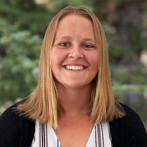
Jillian Wulf
Scientist

Jillian Wulf

Scientist (951) 704-9562 Carlsbad, CA jwulf@integral-corp.com

Ms. Jillian Wulf is a scientist with 7 years of field and project experience in water quality monitoring, stormwater compliance, regulatory support, and sediment sampling. She has played key roles in conducting large-scale environmental programs across Southern California, including per- and polyfluoroalkyl substances (PFAS) groundwater and drinking water assessments on tribal lands, municipal separate storm sewer system (MS4) NPDES watershed monitoring programs, and U.S. Army Corps of Engineers (USACE) dredging investigations. Her technical versatility, combined with strong field leadership and reporting capabilities, makes her an asset to multidisciplinary environmental projects.

Ms. Wulf brings a strong background in coordinating and executing water quality sampling programs. She serves in both assistant project manager and field lead roles, overseeing sampling events, interfacing with laboratories, and ensuring timely and accurate data reporting to regulatory agencies. Her experience includes quality control of analytical and field monitoring data, managing real-time storm event monitoring, conducting dry-weather flow investigations, and supporting the development of sampling standard operating procedures for emerging contaminants.

Additionally, Ms. Wulf provides regulatory support through data validation, reporting, and QA/QC review. She also develops and maintains GIS mapping tools to support planning, reporting, and stormwater infrastructure assessments. Her combination of technical expertise, regulatory knowledge, and team coordination skills makes her a valuable contributor to multidisciplinary environmental projects.


Environmental Monitoring

Upper San Gabriel River Enhanced Watershed Management Program, Los Angeles County, California As an assistant to the project manager, manages daily field operations across multiple sites in support of the Los Angeles Regional MS4 NPDES permit compliance monitoring under the Upper San Gabriel River Coordinated Integrated Monitoring Program (CIMP). Leads wet- and dry-weather sampling events, programs and maintains automated samplers and field equipment, and ensures adherence to permit protocols. Assists with field data quality control review and reports to the client in a timely manner, while ensuring compliance with permit protocols. Supports watershed-scale best management practice (BMP) implementation and adaptive management decisions under the CIMP.
Best Management Practice Observations, Oceanside, California Third-party observer for structural BMP testing, conducting routine site observations to document performance evaluations. Records detailed notes and photographs of the testing procedures, and drafts observation letters certifying the integrity of the testing process. Verifies that installed BMPs meet required performance and design standards, supporting regulatory compliance and the effectiveness of local water quality management strategies.
Implementation of the Los Cerritos Channel Watershed CIMP, Los Angeles County, California Participates as a field lead for conducting wet- and dry-weather monitoring in support of the Los Angeles Regional MS4 NPDES permit. Responsible for collecting grab and composite samples, processing subsamples, coordinating with laboratories, and collecting in situ water quality data. Installs, maintains, and removes long-term sampling equipment at multiple sites at the start and end of the storm season. Additional duties include maintaining and calibrating monitoring equipment, conducting analytical data quality control reviews, and contributing to report preparation in support of regulatory compliance.
Implementation of the Lower Los Angeles River and Lower San Gabriel River CIMPs, Los Angeles County, California Participates in watershed monitoring to meet Los Angeles Regional MS4 NPDES permit and total maximum daily load (TMDL) requirements. Conducts wet- and dry-weather sampling, installs and maintains monitoring equipment, and assists with the deployment of remote telemetry systems for flow-triggered sampling. Performs field operations in alignment with health and safety protocols, and assists in conducting analytical data review and quality control checks for regulatory compliance reporting.
Implementation of the City of Long Beach Nearshore (Non-Port) Watershed Integrated Monitoring Program (IMP), Long Beach, California Assists in conducting sampling for estuarine and beach monitoring programs during both wet- and dry-weather events in support of Los Angeles Regional MS4 NPDES permit compliance. Performs field operations, maintains and calibrates monitoring equipment, and assists in conducting analytical data review and quality control checks in preparation for regulatory compliance reporting.
San Diego County As-Needed Water Quality Monitoring, San Diego, California Supported water quality monitoring efforts by preparing field equipment, coordinating team logistics, and conducting sampling during wet- and dry- weather events. Contributed to the Illicit Discharge Detection and Elimination (IDDE) program by inspecting outfalls and conveyances and producing site maps using ArcGIS Pro. Participated in BMP monitoring by performing wet-weather sampling to evaluate treatment performance, and conducted biweekly low-flow monitoring during dry weather, including site preparation and data reporting to support regulatory compliance.

GIS Design

Los Angeles County CIMPs, Los Angeles, California Specialist in developing and updating spatial data products in ArcGIS Pro to support the Lower Los Angeles River, Los Cerritos Channel, and Lower San Gabriel River CIMPs. Produces high-quality maps illustrating monitoring station locations, watershed boundaries, and land use features to aid field planning, regulatory reporting, and stakeholder communication.
City of Long Beach Estuarine and Beach Watershed IMP, Long Beach, California Specialist in developing and updating spatial data products in ArcGIS Pro to support the Long Beach Estuarine and Beach Watershed IMP. Produces high-quality maps illustrating monitoring station locations, watershed boundaries, and land use features to aid field planning, regulatory reporting, and stakeholder communication.
San Diego County As-Needed Water Quality Monitoring, San Diego, California Specialist in creating detailed site maps of outfalls and drainage conveyances in ArcGIS Pro for the County of San Diego’s As-Needed Water Quality Monitoring Project. Supported the IDDE program by producing accurate, field-ready maps to guide investigations and ensure regulatory compliance. Integrated spatial data with field observations to enhance planning, reporting, and enforcement of stormwater management practices.
Illicit Discharge Survey Recording in ArcGIS Collector, United States Utilizing ArcGIS Collector to record outfalls, drainage features, and Illicit Discharge Surveys (IDS) during field inspections at multiple sites across the United States. Collected geospatial data in real time and conducted post-survey data editing and quality control in ArcGIS Online. Supported accurate mapping and data integration for stormwater infrastructure assessments and regulatory compliance efforts.

Groundwater Monitoring

Rincon Band of Luiseño Indians Groundwater Monitoring, Rincon Reservation, California Assists the Project Manager in coordinating field team and managing groundwater sampling across tribal lands in support of ongoing water quality monitoring efforts. Conducts quarterly sampling using low-flow bladder pumps to collect representative samples for laboratory analysis. Regularly coordinates with the laboratory to ensure proper sample handling and reporting. Submits sampling data in comprehensive quarterly reports to inform sustainable groundwater management and long-term resource planning, while supporting the environmental health of tribal water resources.

Health And Safety

Health and Safety Compliance Programs, United States Supported various hazardous material, hazardous waste, and health and safety tasks. Edited health and safety plans for multiple locations to ensure compliance with local, state, and federal regulations.

NRDA For Oil Spills

Pipeline P00547 Oil Spill Incident, Huntington Beach, California Led field activities in support of spill response operations following an offshore oil pipeline rupture. Assisted with coordinating logistics, and managed and conducted beach user surveys. Served as point-of-contact for field staff across multiple agencies conducting beach user surveys.

PFAS

Rincon Band of Luiseño Indians PFAS Monitoring, Rincon Reservation, California Assists with coordinating and conducting sampling for PFAS at six groundwater production wells in support of complying with the Fifth Unregulated Contaminant Monitoring Rule (UCMR5). Participates in developing PFAS sampling standard operating procedures, training staff in contamination control protocols, and ensuring ultra-clean sampling conditions that are critical for trace-level analysis. Manages field teams, leads sampling events, and coordinates directly with the analytical laboratory to maintain data integrity. This work supports regulatory compliance, safeguards the environmental health of tribal water resources, and contributes valuable data for sustainable groundwater management.

Regulatory Support

Regulatory Support for Transportation Client, United States Supported and researched the permitting process for aboveground storage tanks in multiple states and drafted the permits to fulfill federal, state, and local requirements. Researched Tier II Emergency Planning and Community Right-to-Know Act submittal requirements and submitted requests to the appropriate agencies for locations in multiple states.
State Reporting Support for Postal Client, California Trained clients on how to submit hazardous materials business plans through the California Environmental Reporting System. Contacted Certified Unified Program Agency regulators to edit rejected submittals.

Sediment Sampling

Environmental and Geotechnical Investigation Project, Encinitas, California Participated in a USACE investigation conducting vibracore sediment sampling to evaluate sediment quality for proposed dredging and beach nourishment activities. Supported core processing, ensured proper sample handling and documentation, and assisted with data reporting to meet environmental permit requirements.
Marina del Rey Harbor Environmental and Geotechnical Investigation Project, Marina Del Rey, California Participated in conducting vibracore sediment sampling and testing to evaluate sediment quality in support of planned USACE maintenance dredging operations. Coordinated logistics for sample collection and processing and ensured timely data reporting to meet environmental permitting requirements.

Site Assessment

Phase I Environmental Site Assessments, California and Nevada Conducted Phase I environmental site assessments for a variety of clients across California and Nevada, including vacant parcels and light industrial properties. Prepared Phase I ESA reports and exit assessments in accordance with ASTM standards in support of property transactions and due diligence efforts.

Stormwater Management

San Diego County As-Needed Water Quality Monitoring, San Diego, California Supported water quality monitoring efforts by preparing field equipment, coordinating team logistics, and conducting sampling during wet- and dry- weather events. Contributed to the Illicit Discharge Detection and Elimination (IDDE) program by inspecting outfalls and conveyances and producing site maps using ArcGIS Pro. Participated in BMP monitoring by performing wet-weather sampling to evaluate treatment performance, and conducted biweekly low-flow monitoring during dry weather, including site preparation and data reporting to support regulatory compliance.
Illicit Discharge Surveys, United States Conducted outfall and storm drain inspections at multiple sites nationwide to assess compliance with federal, state, and local stormwater regulations. Reviewed MS4 NPDES permits and as-built drawings to verify system configurations and regulatory alignment. Documented findings and prepared IDS reports in support of client compliance efforts.
Wet-Weather Monitoring, United States Managed wet-weather monitoring program filed operations for a railroad client. Conducted grab sampling, in situ water quality measurements, and visual observations during storm events. Ensured compliance with railroad safety protocols and sampling procedures throughout field operations.

Surface Water Monitoring

Rincon Band of Luiseño Indians Surface Water Monitoring, Rincon Reservation, California Assists with coordinating field team and managing surface water sampling from eight sites across tribal lands in support of ongoing water quality monitoring efforts. Conducts quarterly sampling to collect representative samples for laboratory analysis and regularly coordinates with the laboratory to ensure proper sample handling and reporting. Performs quality control on analytical data and submits results in comprehensive quarterly reports to inform sustainable surface water management and long-term resource planning.
Rincon Band of Luiseño Indians Algal Monitoring, Rincon Reservation, California Manages monthly algal sampling from a surface water site on tribal lands to support ongoing water quality monitoring efforts. Conducts sampling to collect representative samples for laboratory analysis and regularly coordinates with the laboratory to ensure proper sample handling and reporting. Performs quality control evaluations of analytical data and submits results in comprehensive quarterly reports to inform sustainable surface water management and long-term resource planning.

Water Quality Monitoring

Rincon Band of Luiseño Indians Drinking Water Monitoring, Rincon Reservation, California Coordinates monthly drinking water sampling for chlorine, total coliforms, and E. coli across multiple distribution systems, including faucets, fire hydrants, and quick-connect stations. Manages field team logistics, schedules sampling events, and manages laboratory coordination to ensure timely and accurate analyses. Performs data quality control, compiles quarterly reports, and ensures compliance with regulatory standards. This work supports the environmental health of tribal water resources and provides critical data to inform sustainable drinking water management and long-term planning.
Upper Tijuana River Nutrient Loading Study, San Diego County, California Participated in water quality monitoring to assess nutrient loading in the Upper Tijuana River. Assisted with field preparation, sampling activities, and data reporting to inform watershed management and regulatory assessments.
Dry-Weather Low-Flow Monitoring Santa Margarita River and San Dieguito River, San Diego County, California Led biweekly low-flow monitoring, including site preparation, field data collection, and equipment maintenance. Assisted in data management and reporting in support of watershed monitoring and regulatory compliance efforts.
San Diego County As-Needed Water Quality Monitoring, San Diego, California Participated in water quality monitoring efforts by preparing field equipment, coordinating team logistics, and conducting sampling during wet- and dry-weather events. Contributed to the IDDE program by inspecting outfalls and conveyances and producing site maps using ArcGIS Pro. Participated in BMP monitoring by performing wet-weather sampling to evaluate treatment performance and conducted biweekly low-flow monitoring during dry weather, including site preparation and data reporting in support of regulatory compliance.
RETURN TO OUR TEAM PAGE