Select Page
Christopher Flanary, Ph.D.
Consultant

Christopher Flanary, Ph.D.

Consultant

Dr. Christopher Flanary is a physical oceanographer with more than 10 years of experience performing site assessments for government agencies and the private sector, including hydrodynamics, sediment transport, contaminant transport, litigation support, and marine energy. Dr. Flanary has managed field operations, data processing and analysis tasks, and complex numerical modeling for environmental characterization, observational monitoring, scientific research, and technology development. His expertise includes the application of state-of-the-science field measurements and 3-dimensional numerical modeling and analysis to characterize and quantify processes in aquatic, terrestrial, and atmo...

Dr. Christopher Flanary is a physical oceanographer with more than 10 years of experience performing site assessments for government agencies and the private sector, including hydrodynamics, sediment transport, contaminant transport, litigation support, and marine energy. Dr. Flanary has managed field operations, data processing and analysis tasks, and complex numerical modeling for environmental characterization, observational monitoring, scientific research, and technology development. His expertise includes the application of state-of-the-science field measurements and 3-dimensional numerical modeling and analysis to characterize and quantify processes in aquatic, terrestrial, and atmospheric systems. His modeling expertise includes coastal hazard modeling in support of vulnerability assessments, specializing in sea level rise, wave run-up, and coastal erosion, providing critical support for at-risk coastal communities. In addition, Dr. Flanary prepares materials for various environmental litigation cases in the United States.

Read More    Read Less   

Renewable Energy

Site Energy Assessment and Monitoring Dashboard (SEAMOD), U.S. Department of Energy Serving as program and product manager for the development of a wave energy resource assessment dashboard that will substantially improve siting, permitting, operations, and maintenance of marine energy projects by providing an integrated site assessment solution that is a one-stop-shop for a developer’s site characterization and monitoring needs. The integrated dashboard will be developed utilizing state-of-the-art data-assimilative modeling tools that can be coupled with low-cost, rapidly deployable wave buoys and environmental sensing hardware. The combined software and hardware solution will reduce wave energy site characterization and wave climate monitoring costs by more than 60 percent and provide assessments that meet international industry standards.
Marine Renewable Energy Support, Sandia National Laboratories, Albuquerque, New Mexico Serving as technical modeling expert for the development of tools and techniques to improve performance, lower costs, and accelerate the deployment of marine and hydrokinetic energy technologies. The project has evaluated all aspects of marine and hydrokinetic resource characterization and environmental evaluations through applied research and developing tools and methods to improve device performance and minimize environmental disturbance. Of particular importance to this project is the development and application of software tools and guidance for the marine renewable energy industry.
Marine Energy Effects on the Environment, Sandia National Laboratories, Albuquerque, New Mexico The U.S. Department of Energy’s mission to develop a robust and safe renewable energy infrastructure requires that stakeholders, permitting agencies, and developers understand and mitigate negative effects to the environment. To support that understanding, worked to develop application methods for numerical models that simulate the effect wave and current energy conversion technologies have on their surrounding environment. This has resulted in the development of the Spatial Environmental Assessment Tool to quantify and compare potential power production and risk to the environment.

Environmental Impact Assessment

Offshore Wind Essential Fish Habitat, East Coast, U.S. On behalf of a confidential commercial developer, provided technical review, metasynthesis, and reporting of extant baseline information on location and extent of essential fish habitat off the coast of southern New England. Evaluated potential impact factors for planning, construction, operation, and conceptual decommissioning. Performed independent analyses to examine potential overlap between fish habitat and a lease area with modeling of population-level consequences to commercially valued demersal fish. The work was performed in support of fisheries engagement, site assessment, and subsequent drafting of a construction and operations plan.
Offshore Cable Electromagnetic Field Modeling and Impact to Marine Life, East Coast, U.S. Served as technical expert for electromagnetic field (EMF) modeling of proposed buried transmission cables located in coastal waters of New York. Modeling of EMF was performed using the FIELDS computer program, developed by Southern California Edison, for both high-voltage direct current and high-voltage alternating current cables as well as custom Python-based code supported by the Biot-Savart law of electromagnetism. Potential modeled exposures to EMF and thermal changes were evaluated relative to current state of the science on potential threshold level impacts to demersal teleost fish, elasmobranchs, and lobster.

Coastal Resilience

Sea Level Rise Vulnerability Assessment for Stanford’s Hopkins Marine Station, Pacific Grove, California Numerical modeling lead for a sea level rise vulnerability assessment and adaptation plan for Stanford University’s coastal marine laboratory in Pacific Grove, California. This included supporting the coastal engineering team to model and visualize the extent of wave run-up and coastal erosion, accounting for all building, utility, and biological resources and assets across the 11-acre campus. The run-up and erosion modeling was used to conduct a site-specific level of hazards analysis detailing locations of building and utility sensitivities, and the ways dynamic wave pressures and flood depths could impact these assets. Working with Stanford’s Land, Buildings & Real Estate Department, the team identified a series of sea level rise trigger points and developed an adaptation plan involving short- to long-term strategies.
Sea Level Rise and Vulnerability Assessment for South Padre Island, Texas Numerical modeling lead for a sea level rise, wave run-up, and coastal erosion vulnerability assessment along the coastline of South Padre Island. South Padre Island is a narrow, low-relief barrier island along the south Texas coastline that is impacted frequently by erosive winter storm events and infrequent, but extremely damaging, major hurricanes. The assessment phase involved modeling of future potential impacts due to storms combined with sea level rise. Advanced state-of-the-science modeling was utilized, incorporating measured data from wave buoys to simulate waves along the South Padre Island coastline. This study identified predicted impacts of potential coastal change during a range of storm events under future sea level rise scenarios.

Air Quality Modeling

Portland Harbor Natural Resource Damage Assessment, Portland, Oregon Served as hydrodynamic and air emissions modeling expert on behalf of a potentially responsible party in assessment of natural resource damages at the Portland Harbor Superfund Site. Technical activities included hydrodynamic model review and independent analysis, and air emissions modeling from multiple historical sources using EPA-approved AERMOD.
Dispersion Modeling for Multipathway Risk Assessment, Louisiana Served as modeling expert for air dispersion and atmospheric deposition modeling to estimate atmospheric transport and wet and dry deposition of gaseous and particle-phase and ‑bound chemicals from an active municipal landfill in support of a multipathway risk assessment. Technical activities included air emissions modeling from multiple historical sources using EPA-approved AERMOD and CALPUFF. Used site-specific meteorological data to determine deposition rates of contaminants in flat and complex (elevated) terrain.

Site Assessment

Hydrodynamic and Sediment Transport Assessment of Planned Construction at U.S. Navy Facility, East Coast, U.S. Served as program manager and technical modeling expert for the development and application of a hydrodynamic and sediment transport model of a large estuarine system to evaluate impacts to hydrodynamic and sediment transport patterns as a result of in water construction and demolition activities. The mixed and variable composition of bedded sediment within the system limits the effectiveness of analytical solutions to estimate parameters relevant to sediment transport, so multiple SEDflume cores were collected onsite to support the numerical model development. Modeling was performed using Deltares Delft3D-FLOW and WAVE and included evaluation and application of a MIKE3 hydrodynamic and sediment transport model.
Lower Passaic River Water Column Monitoring for Predesign Investigation, New Jersey Obtained real-time water quality and hydrodynamic measurements throughout the lower 8.3 miles of the Lower Passaic River to support remedial design. Water column data were used to develop a relationship between in situ data and chemical concentrations and to quantify suspended sediment concentration flux. Results will be used to establish baseline criteria and resuspension engineering performance standards for dredging and capping activities.
Yosemite Slough Preremedial Design Investigation, San Francisco, California Served as the technical numerical modeling expert to support an EPA non-time-critical removal action of lead- and PCB-contaminated sediments at the Yosemite Slough Superfund site.  A hydrodynamic and sediment transport model was developed to assess cap stability to support engineering design.  A field study was performed to collect site-specific data to set up and calibrate the models, and model predictions of bed shear stress and residual transport during tidal and storm conditions will be used in future design of the capping and dredging remedy.
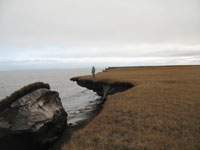
Arctic Coastal Erosion: Modeling and Experimentation, North Slope, Alaska Permafrost along Alaska’s north slope comprises 34 percent of the world’s coastlines.  Due to heightened wave activity and temperatures, erosion of the permafrost coastline can exceed 10 m/year and is increasing.  Current tools for predicting coastal evolution were developed for temperate areas and non-cohesive sediments, limiting their applicability for permafrost coastlines.  To develop adaptation strategies for Arctic infrastructure, accurate methods of predicting these discrete events are needed.  Teamed with Sandia National Laboratories, the U.S. Geological Survey, University of Alaska Fairbanks, and University of Texas at Austin, Integral led the development of a numerical modeling system to predict hydrodynamics and waves along Arctic coastline.  These hydrodynamic predictions were integrated into a terrestrial processes model used to quantify rates of permanent coastal land loss.
Berry’s Creek Hydrodynamic and Sediment Transport Modeling, East Rutherford, New Jersey The Berry’s Creek Study Area (BCSA) is a tidal wetland/marsh adjacent to the Hackensack River.  Historical releases of contaminants into the BCSA have resulted in the need for an RI/FS for the site.  The study’s goal is to characterize the fate and transport of sediment-bound contaminants.  Responsibilities included calibrating and validating the Environmental Fluid Dynamics Code 2-dimensional numerical hydrodynamic and sediment transport model of Berry’s Creek.  The data are guiding a quantitative description of hydrodynamics and sediment transport in the system, providing contaminant fate and transport input to the risk analysis and remedial selection and design.
Sediment and Contaminant Transport Investigation, Lower Penobscot River, Maine The lower Penobscot River is a tidal river subject to tidal action from the Atlantic Ocean and river flow from the upper Penobscot River.  Releases of mercury associated with discharges into the system have resulted in contamination.  Led the development and analysis of a high-resolution, 3-dimensional numerical model of hydrodynamics and sediment transport to evaluate remedial actions in the river.  These model predictions are guiding a quantitative description of riverine dynamics, providing contaminant fate and transport input to the risk analysis and remedial selection and design.
Numerical Model of Central East Florida Shelf Cold Water Upwelling, Melbourne, Florida Developed a Regional Ocean Modeling System 3-dimensional numerical ocean model of the central east Florida shelf to hindcast summer cold water upwelling.  Collected in situ acoustic Doppler current profiler (ADCP) data along the Florida shelf for model skill assessment.  Developed 3-dimensional initial conditions and boundary conditions from basin-scale ocean and atmospheric numerical models.  Performed statistical and graphical analyses of results using MATLAB®.
Sebastian Inlet Oceanographic and Meteorological Monitoring, Sebastian Inlet, Florida Managed field operations and data processing of multiple ADCPs and meteorological instrumentation at Sebastian Inlet State Park, Florida.  Led development of interactive front-end web interface for public access to data and provided support to Sebastian Inlet hydrodynamic and sediment transport model used for the annual sediment budget.

Litigation Support

Sediment, Fate and Transport Modeling, Confidential Site Supported testifying expert on sediment and contaminant transport modeling for Superfund site allocation.  Tasks included modeling hydrodynamics, sediment transport, and contaminant transport to aid remedial actions. Performed analysis of model predictions and measured data to support expert opinions and provide content for expert report.
Modeling Landfill Emissions for Litigation Support, Confidential Site Conducted emissions and air dispersion modeling for existing municipal landfills.  Emissions modeling included estimates of emission rates of contaminant from capped landfill.  Air dispersion modeling required estimates of short-term air concentrations at the facility and short- and long-term air concentrations at various offsite locations.

Data Analysis

Sebastian Inlet Oceanographic and Meteorological Monitoring, Sebastian Inlet, Florida Developed real-time MATLAB® and MSDOS scripts to collect and process data from NOAA National Data Buoy Center stations and remote real-time oceanographic and meteorological instrumentation.  Performed various regression and correlation statistics on data.  Created real-time scripts to upload data streams to NOAA National Data Buoy Center’s online data dashboard and visualization tool.

Surveying

Beach Erosion Surveys, Dominicus, Dominican Republic Topographic and hydrographic surveying using traditional rod and transit of resort beaches for possible submerged breakwater installations.  Performed data analysis of survey data to determine beach volume changes.
Beach Erosion Surveys, Providenciales, Turks and Caicos Topographic and hydrographic surveying using traditional rod and transit for submerged breakwater installations along commercial and private beach fronts.  Performed data analysis of survey data to determine beach volume changes.
Topographic Survey of Airfields, Ascension and Antigua Islands Performed topographic surveys of drainage areas around military and commercial runways.  Used RTK-GPS backpack system and total station to create a topographic map of the drainage fields.
RETURN TO OUR TEAM PAGE