Select Page
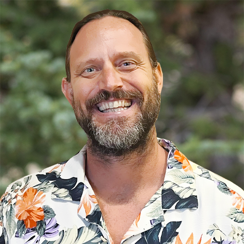
Andrew Wycklendt, P.E., BCCE
Senior Engineering Advisor

Andrew Wycklendt, P.E., BCCE

Senior Engineering Advisor

Mr. Andrew Wycklendt is a board-certified coastal engineer (BCCE) through the Academy of Coastal, Ocean, Port and Navigation Engineers (ACOPNE), a subsidiary of the American Society of Civil Engineers; with only 79 Board Certified Coastal Engineers worldwide, this is the highest certification given to a professional engineer within the field of coastal engineering. He has 18 years of coastal engineering experience designing and implementing a variety of coastal restoration, shoreline protection, sediment management, dredging, navigation, waterfront structure, and flood mitigation projects along Pacific, Atlantic, Gulf, and Arctic coasts. He has worked with barrier island, headland and emb...

Mr. Andrew Wycklendt is a board-certified coastal engineer (BCCE) through the Academy of Coastal, Ocean, Port and Navigation Engineers (ACOPNE), a subsidiary of the American Society of Civil Engineers; with only 79 Board Certified Coastal Engineers worldwide, this is the highest certification given to a professional engineer within the field of coastal engineering. He has 18 years of coastal engineering experience designing and implementing a variety of coastal restoration, shoreline protection, sediment management, dredging, navigation, waterfront structure, and flood mitigation projects along Pacific, Atlantic, Gulf, and Arctic coasts. He has worked with barrier island, headland and embayment, estuarine, deltaic, cliff, pocket, perched, and open coastal systems to restore or nourish beaches, marshes, and other habitat that can be classified as either sand, mixed sediment, vegetated, cobble, boulder, or volcanic. Project experience includes dredge and fill (for disposal, nourishment, or restoration), coastal structure (breakwaters, groins, jetties, revetments, and seawalls), and marine-related upland structures (beach access stairs, boardwalks, boat ramps, docks, piers, and quays).

Mr. Wycklendt is versed in all aspects of the coastal engineering discipline, inclusive of coastal modeling, project design, permitting, bid and construction document preparation, construction oversight and administration, topobathymetric and biological surveys, geophysical and geotechnical investigations, and oceanographic studies. He manages broad-based coastal engineering projects, inclusive of marketing and sales, client contact, team coordination and collaboration, feasibility analyses, engineering designs, numerical modeling, report preparation, permitting, construction engineering, and monitoring services. He collaborates across disciplines to effectively convey complex information to colleagues, stakeholders, and the public. Specific responsibilities include the following:

  • Lead project teams in the coastal project design process from conceptual design to detailed design ready for bid and construction
  • Perform project management activities in a lead role being responsible for scope, budget, and schedule while working in close coordination with the project team, sub-consultants, and client
  • Design, manage, and contribute to field programs and data analysis
  • Define numerical modeling needs, provide guidance to the modeling team, and QA/QC modeling results
  • Analyze environmental effects and project performance using analytic and numeric models
  • Design coastal projects and estimate construction costs
  • Develop construction plans and specifications
  • Administer coastal construction projects.
Read More    Read Less   

Coastal Engineering

Barrier Island Restoration Program, Louisiana Six barrier island restoration projects (Chaland Headland, Shell Island, Pelican Island, West Bell Pass, East Grand Terre, and Chenier Ronquille) constructed along 15.5 miles of Gulf shoreline included the dredging and placement of 18,362,000 cubic yards of sand and 9,016,000 cubic yards of mixed sediment to restore 1,441 acres of beach and dune and create 2,181 acres of marsh. Several of these barrier island restoration projects were augmented by the emergency berm that included the dredging and placement of 10,000,000 cubic yards of sand to protect interior marshes from the Deepwater Horizon oil spill. As project engineer, designed three of these projects (Shell Island, West Belle Pass, and Chenier Ronquille) and the emergency berm, provided bid support services for five of these projects (all except Chaland Headland), and provided construction engineering support services for all of these projects. Specific design tasks performed include the following: engineering assessment to evaluate various footprint configurations and the ability to construct a primary dike to contain marsh fill necessary to meet both habitat restoration and design life requirements, feasibility analysis of dredging access and using in situ material to construct the primary dike within the web of oil and gas infrastructure, extreme event analyses to define design conditions, numerical modeling to define cross-section design requirements that considered both storm erosion and overwash, engineering assessments to develop a sediment budget and define advanced fill requirements, fill volume calculations that account for settlement or consolidation and offshore losses necessary to properly design offshore borrow areas, project performance projection calculations to assess wetland value acreage within specific tidal elevation ranges, and probable construction cost and timeline estimates. Design recommendations were provided based on review and analytical comparison of morphological modeling results. Developed construction plans and specifications to prepare bid packages.
Dare County Beach Nourishment Program, North Carolina As project engineer, completed various engineering and modeling tasks to help design and plan beach nourishment projects for the towns of Duck, Southern Shores, Kitty Hawk, and Kill Devil Hills. These four towns participated in a comprehensive beach nourishment project between May and October 2017 that included the dredging and placement of 3,927,000 cubic yards of sand to provide storm protection along 8.3 miles of Atlantic shoreline and restore 80 acres of beach. Used several models to support project design: 1) the Storm Induced Beach Change (SBEACH) model that simulates profile changes that result from varying storm waves and water levels to evaluate cross-shore performance, 2) the Generalized Model for Simulating Shoreline Change (GENESIS) model that simulates shoreline changes that result from variations in the wave driven longshore transport to evaluate longshore performance, 3) the Simulating Waves Nearshore (SWAN) model that simulates wave propagation while accounting for the shoaling, refraction, diffraction, wind growth, whitecapping, and bottom damping of spectral waves, and 4) various run-up models used to evaluate the extent of wave inundation. To support project design and modeling, reviewed available wave, water level, and wind data and completed extreme analyses to define return period events and design conditions; analyzed water level data to develop relative sea level rise projections; analyzed historic shorelines and calculated shoreline change; analyzed profile data to define the active profile height; calculated volume changes using surface, profile, and shoreline based methods; and developed a sediment budget. The SWAN, GENESIS, and SBEACH models were then calibrated using data collected at the U.S. Army Corps of Engineers (USACE) Field Research Facility, while the run-up model was selected by comparing various analytical models with measurements collected along the Town of Kitty Hawk. Advanced fill requirements defined using the sediment budget, combined with design cross-sections developed using the SBEACH model and taper designs developed using the GENESIS model, were used to define design alternatives that offered various levels of protection.
Statewide Small-Scale Beach Restoration Program, Hawaii As project manager, developed the statewide small-scale beach restoration (SSBR) program in collaboration with the State of Hawaii Department of Land and Natural Resources Office of Conservation and Coastal Lands and the USACE Honolulu District. Worked with team members to prepare a comprehensive Programmatic Environmental Assessment to support program development and pursuit of a Regional General Permit, Conservation District Use Permit, and a Programmatic Agreement. Evaluated and defined program purpose and need, identified and detailed the proposed action and alternatives, defined best management practices to avoid or minimize environmental impacts, and outlined required environmental regulations and permits. The purpose of the SSBR program is to provide a streamlined permitting approach that allows for the implementation of coastal erosion control projects that result in ecosystem restoration. Actions included within the program (beach management, beach maintenance, and beach stabilization) were designed to manage erosion threats to shoreline property and infrastructure, reduce impacts associated with climate change and sea level rise, and increase overall coastal resilience. Other benefits include ensuring the continued provision of habitat for various threatened and endangered species, protecting cultural sites and burials in the backshore, and improving water quality by providing a natural buffer between waves and exposed soil deposits, and onsite sewage disposal systems along eroded shorelines.
Repair of Metals Landfill Stone Revetment, Adak, Alaska As engineer of record, helped develop a construction work plan for Naval Facilities Engineering Command Northwest for the repair of a damaged rubble-mound revetment to protect the metals landfill (SWMU 13) at the former naval air facility on Adak Island, Alaska. Design wave conditions, used to appropriately size armor stone, were evaluated using the numerical wave transformation model SWAN; this wave model study was a critical design tool as it showed that large Bering Sea waves were able to propagate across Sitkin Sound and enter Kuluk Bay. Construction plans and specifications that considered remote location limitations, were developed to support the work plan. Immediately prior to construction, a small unmanned aircraft system (UAS) was used to map the project site and update the construction plans accordingly. Drone imagery and resultant point cloud data were used to map structure elevations, side slopes, stone sizes, and relative stability. Relative stability was then used to rank repair areas in terms of damage susceptibility to best use available funds. Following construction, a small UAS was used to collect data needed to create as-built drawings and confirm placement quantities and improved structural stability. Drone imagery and resultant point cloud data were used to map postconstruction elevations, side slopes, stone sizes, and relative stability and graphically show or calculate elevation changes, slope changes, quantity and size of stones placed, changes in the stone size distribution, and the extent of stability improvements. The project completion report was approved by the Alaska Department of Environmental Conservation without comment.
Martin County Boat Ramp Improvements, Martin County, Florida Provided professional engineering services necessary to completely replace and improve the sustainability and adaptability of the boat ramps, waterfront structures, and associated access at Sandsprit Park and Stuart Causeway. Both projects included the development of an adaptation management plan that considered sea level rise and storm forces (waves, currents, tides, and surge) and their effects on boat ramp and waterfront structure use and sustainability. Provided recommendations for adapting the boat ramps and waterfront structures to sea level rise and increased community use. For example, the Sandsprit Park boat ramp incorporated floating docks and gangways to adapt to sea level rise. For the Stuart Causeway boat ramp floating docks were considered, however, the long fetch at this site results in wave conditions that exceed those recommended for floating dock use. The client did not want to place a wave screen adjacent to the navigation channel in the Intracoastal Waterway; therefore, a novel concept of designing adjustable composite docks was pursued at the Stuart Causeway site. The Sandsprit Park boat ramp improvement project included the demolition of two concrete boat ramps, two floating docks, four fixed timber docks, and one concrete bulkhead/groin and included the construction/installation of two concrete boat ramps with vinyl sheet pile scour protection, three floating concrete docks, three aluminum gangways, two fixed timber docks, two custom fendering systems, one steel sheet pile bulkhead/groin extension, one concrete bulkhead/groin, Americans with Disabilities Act (ADA) parking and access, overflow lot, and gutter/curb improvements. The Stuart Causeway boat ramp improvement project includes the demolition of one concrete boat ramp and three fixed timber docks and proposed construction/installation includes one concrete boat ramp with vinyl sheet pile scour protection, three adjustable composite docks, two vinyl sheet pile fendering systems, four plastic lumber fendering systems, extending a rubble mound revetment, installing beach mats, ADA parking and access, and gutter/curb improvements. As project manager, planned and coordinated engineering site investigations and assessments, geotechnical explorations and studies, topobathymetric and biological surveys, and environmental compliance sampling and analysis. As project engineer, developed demolition and conceptual design plans, completed feasibility study, prepared adaptation management plan, completed technical studies and analyzed design forces (soil, wind, wave, berthing), used value engineering to finalize design, coordinated NEPA documentation to obtain state and federal permits, prepared construction cost estimate and schedule, compiled specifications from various technical resources and codes, and prepared construction plans according to internal CAD policies and procedures. During Sandsprit project construction, worked with civil engineering staff to appropriately model and develop plan modifications to resolve a reported trailer scraping problem that occurred at the boat ramp and upland parking lot transition and rapidly developed a design to repair a bulkhead that failed when the contractor did not appropriately brace load bearing walls when the site was dewatered during a king tide event.
Letter of Map Revision, Long Beach, New York As project manager and coastal flood mapping specialist, completed a flood risk assessment and prepared a letter of map revision (LOMR) request for beach development. The flood risk assessment included due diligence research and completing a coastal engineering analysis to assess coastal flood risk and identify mitigation alternatives. Construction plans prepared for the development site were reviewed to identify any modifications that could be made to reduce flood insurance requirements. It was learned that the development site is currently located within the Coastal High Hazard Area (zone VE) flood zone and has a base flood elevation (BFE) of 16 ft referenced to the North American Vertical Datum of 1988 (NAVD). However, after the Federal Emergency Management Agency (FEMA) published the effective Flood Insurance Study and Flood Insurance Rate Map, which are based on 2005 topographic data, USACE constructed a hurricane and storm damage reduction project along the fronting beach. As demonstrated using FEMA approved Wave Height Analysis for Flood Insurance Studies model included within the Coastal Hazard Analysis Modeling Program, this project reduces the flood risk at the development site, which theoretically removes it from the Coastal High Hazard Area (VE) flood zone and reduces the BFE to 15 ft NAVD. Consequently, a LOMR application (MT-2) was prepared and submitted to FEMA requesting that the flood zone designation at the project site be changed from a VE16 to an AE15. Responded to additional data requests as necessary to support FEMA review and ultimate approval of the LOMR request.  
RETURN TO OUR TEAM PAGE