
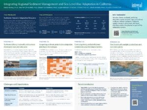
Key takeaway: Beaches, dunes, wetlands, and living shorelines cannot provide long-term climate resilience without sediment. Sediment supply, transport, placement, and reuse therefore need to be planned as part of the adaptation system.
The Problem
Sediment: Nature’s Adaptation Resource
Regional Sediment Management Plans (RSMPs) operate at the scale of littoral cells, while climate adaptation planning is normally conducted at the local jurisdictional level. Although both depend on the same sediment system, they are often developed by different disciplines and agencies with different vocabularies and competing objectives. Sediment is the focus of flood control and of ports and harbors, while adaptation is the focus of long-range planners. This results in limited coordination, implementation detail, or alignment of funding and permitting pathways.
The Approach
We reviewed BEACON region adaptation plans, scored all 11 California RSMPs across eight sediment management themes using a standardized 0 to 3 rubric, and surveyed coastal practitioners to identify integration gaps, implementation barriers, and opportunities to better align sediment management with climate adaptation.
- 8 BEACON jurisdictions studied
- 11 RSMPs reviewed
- 124 planning documents reviewed
- Statewide practitioner survey distributed to 252 practitioners, with 87 responses
Eight themes reviewed: Governance, Sediment Sources, Projects, Sea Level Rise, Grain Size, Financing, Staffing, and Coastal Economics.
Finding #1: Sediment Delivery Is Episodic and Contains Mixed Grain Sizes, Not Only Sand
Many RSMPs rely on average annual sediment budgets and remain strongly sand-focused. In reality, sediment delivery is highly episodic, driven by floods, debris flows, landslides, dredging, and other events. These sediments are more than just sand: they include muds, silts, sand, cobbles, and boulders, all important for maintaining beach, wetland, and marine habitats.
Different grain sizes provide different adaptation functions, and extreme events can create short-lived opportunities for beneficial reuse.
Finding #2: Integrating Sediment Projects into Adaptation Planning Is the Main Gap
All 11 RSMPs identify sediment sources. The gap is implementation: governance, financing, staffing, sea level rise (SLR) integration, grain-size considerations, and pathways from planning to implementation vary widely.
Extent of Treatment by RSMP
0 = Not addressed, 1 = Limited, 2 = Moderate, 3 = Well developed
| RSMP | Sediment Sources | Financing | Projects | Economics | SLR | Governance | Staffing | Grain Size |
|---|---|---|---|---|---|---|---|---|
| Southern Monterey Bay 2008 | 3 | 3 | 0 | 3 | 2 | 1 | 2 | 0 |
| Santa Barbara Littoral Cell 2009 | 3 | 3 | 3 | 3 | 0 | 3 | 1 | 0 |
| San Diego County 2009 | 3 | 3 | 0 | 3 | 1 | 1 | 0 | 2 |
| Orange County 2013 | 3 | 1 | 2 | 2 | 2 | 1 | 3 | 3 |
| Santa Cruz 2015 | 3 | 3 | 3 | 1 | 1 | 2 | 3 | 0 |
| San Luis Obispo 2016 | 3 | 3 | 3 | 1 | 3 | 2 | 0 | 0 |
| Los Angeles County 2017 | 3 | 1 | 0 | 1 | 0 | 3 | 2 | 2 |
| Eureka Littoral Cell 2017 | 3 | 1 | 3 | 0 | 1 | 3 | 0 | 3 |
| San Francisco Open Coast 2017 | 3 | 3 | 1 | 3 | 3 | 2 | 1 | 1 |
| Sonoma and Marin 2018 | 3 | 3 | 3 | 1 | 3 | 3 | 3 | 1 |
| San Francisco Central Bay 2017 | 3 | 0 | 1 | 3 | 0 | 1 | 2 | 3 |
Finding #3: Costs, Regulatory, and Jurisdictional Complexities Pose the Largest Barriers
Practitioners identified their top three biggest barriers:
- 20.3%: Costs
- 17.7%: Jurisdictional complexity
- 17.2%: Regulatory approval requirements
Together, these results show a fundamental mismatch: sediment moves across jurisdictional boundaries, while funding, permitting, and management remain fragmented.
Main Obstacles to Effective Regional Sediment Management
Survey results from 87 coastal practitioners (select all that apply).
| Obstacle | Share of Responses |
|---|---|
| Costs | 20.3% |
| Jurisdictional complexity | 17.7% |
| Regulatory approval requirements | 17.2% |
| Uncertainty about sediment sources | 10.9% |
| Insufficient political support | 10.4% |
| Lack of authority | 7.8% |
| Other | 6.3% |
| Lack of clear science/data | 4.7% |
| Lack of community consensus | 4.7% |
Finding #4: One Littoral Cell, Multiple Jurisdictions, and Even More Plans
BEACON-region adaptation plans vary widely in how sediment is incorporated. Most prioritize living shorelines. Some explicitly consider dredging, nourishment, grain-size compatibility, and flood-control sediments, while others barely recognize sediment as an adaptation resource. Adaptation depends on sediment sources, transport, and governance that extend beyond jurisdictional boundaries, highlighting the need for regional collaboration.
In the BEACON littoral cell, adaptation decisions are local, but sediment sources, transport, and governance are regional.
Challenges and Opportunities
| Category | Challenge | Opportunity |
|---|---|---|
| Governance & Staffing | Sediment managers, planners, harbor districts, and public works often operate separately. | Create shared regional governance linking sediment and adaptation planning. |
| Grain Size & Sources | RSMPs remain sand-focused, and average annual budgets miss episodic sediment pulses. | Plan for muds, silts, cobbles, debris flows, landslides, and dredged sediment. |
| Financing & Coastal Economics | Local funding and conventional benefit-cost analyses undervalue coastal resilience benefits. | Treat beaches, dunes, and wetlands as natural infrastructure. |
| Projects & SLR Integration | Transport, storage, permitting, and long-term SLR integration remain weak. | Link RSMP updates and pilot projects directly to adaptation pathways. |
Recommendations
- Align RSMP projects with climate adaptation planning, including Local Coastal Plans, General Plans, Local Hazard Mitigation Plans, and Capital Improvement Plans.
- Plan for sediment of all sizes and sources, from muds and silts to sand, cobbles, and boulders.
- Build regional governance across disciplines and jurisdictions, including planners, public works, harbor districts, tribes, and underserved communities.
- Streamline permitting and create implementation-ready sediment inventories and pathways.
- Treat beaches, dunes, wetlands, and living shorelines as natural infrastructure and quantify their multibenefit value.
- Use pilot projects, monitoring, and adaptive management to turn planning into implementation.
Contact
David Revell, Ph.D.
Coastal Geomorphologist, Integral Consulting Inc.
(831) 576-2884 | drevell@integral-corp.com